
Leg II — September 2009 Data and Plots
updated 10/5/2010
Download Data:
RU09_CTDdata.zip
(114 files in zip format for pc)
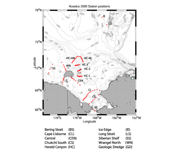
Download Station Map:
Rusalca 2009 CTD Station Map
Download Position Table:
Position Table
Download Time/Position text file:
Time/Position Text File
Download CTD Processing Documentation:
Processing Report
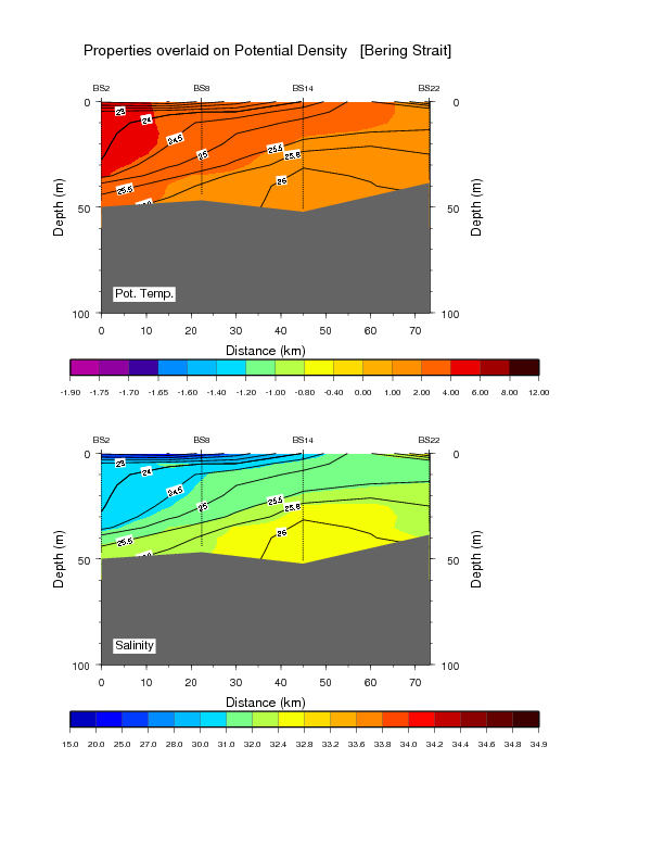
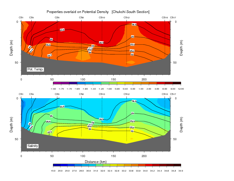
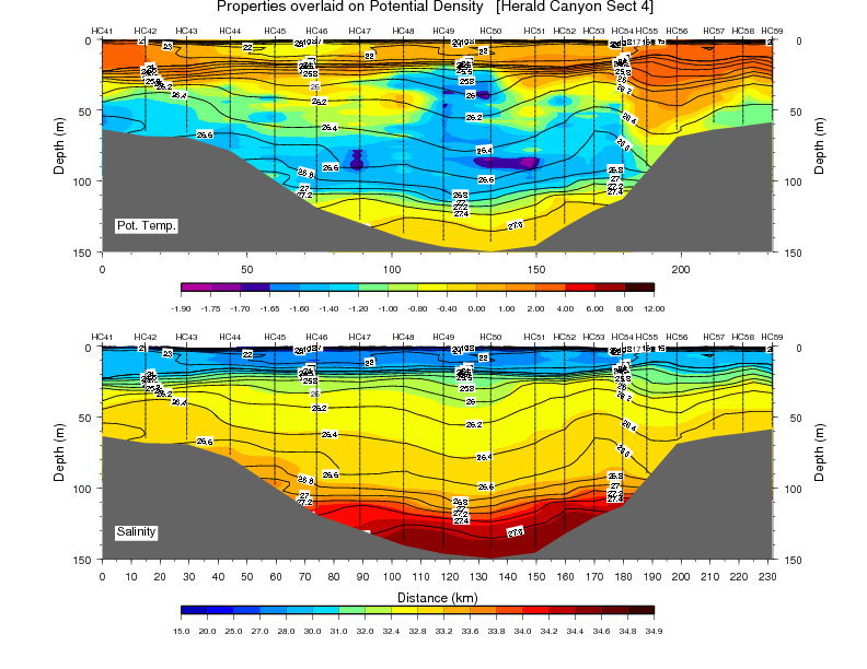
View Vertical Sections
NOTE: These section plots are preliminary and will be updated as data analysis progresses.
- Bering Strait
- Cape Lisburne
- Chukchi South
- Herald Canyon Section 4
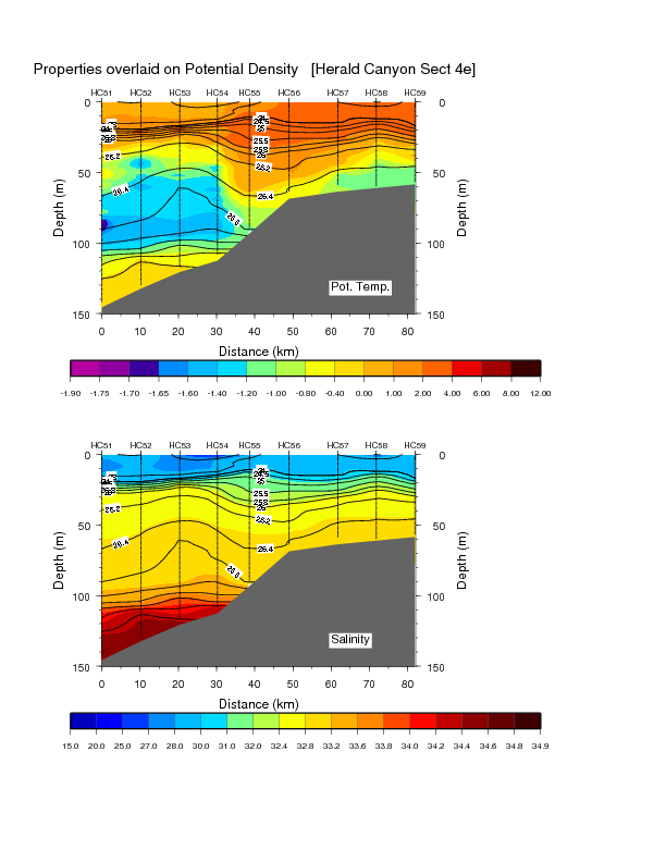
- Herald Canyon Section 4E
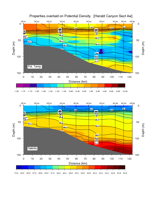
- Herald Canyon Section 4W
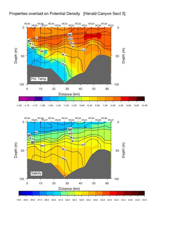
- Herald Canyon Section 3
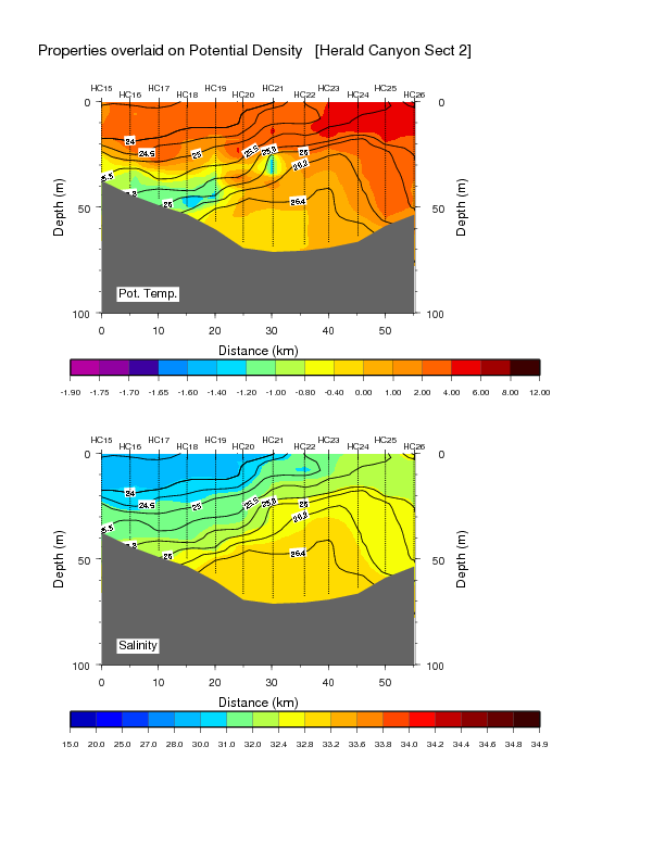
- Herald Canyon Section 2
- Herald Canyon Section 1
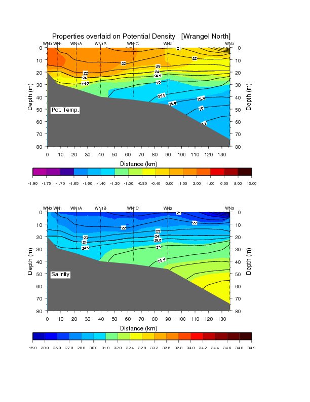
- Wrangel North
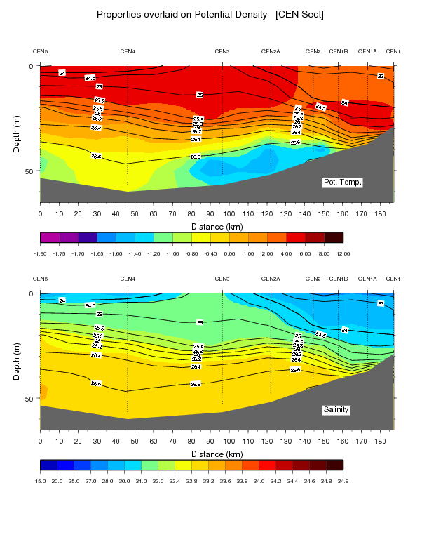
- Central
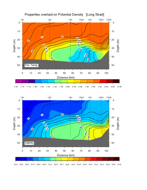
- Long Strait
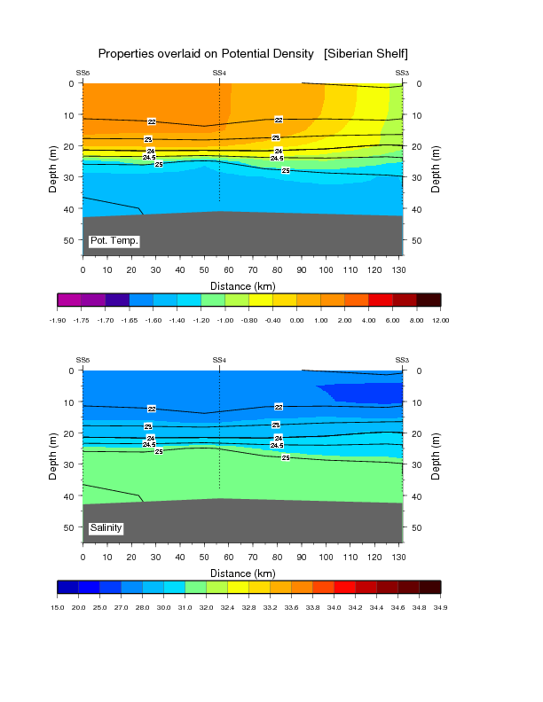
- Siberian Shelf
Download Complete Set (13 transects) of Vertical Sections here:
Download *complete set* of Profile Plots for 114 stations here:
This is a two page set consisting of:
- Page 1: Station Position Map plus profiles of Temperature, Salinity, and Potential Density
- Page 2: Profiles of Oxygen, Beam Attenuation, Fluorescence, and CDOM
- Rusalca09_ProfilePlots.zip

